Route of Nuraghes
along a well marked
Along the road leading to the south coast of the island, located in beautiful scenery, numerous sites are located and testimonies of the Nuraghic period. These are easily accessible through the guided tours and clearly identifiable.
The dolmen had a control function to protect against incursions, also highlighted by their location.
Among the most important are the dolmen de S'Ega Marteddu, to Maladroxia, to control the Gulf of Palmas, while the dolmen Feminedda is near the Fontana Canal.
Nuraghe Corongiu Murvonis, dolmen Noccus and Nuraghe Grutt'acqua, are placed in the center of the island, around, there is any sign of nuragic villages.
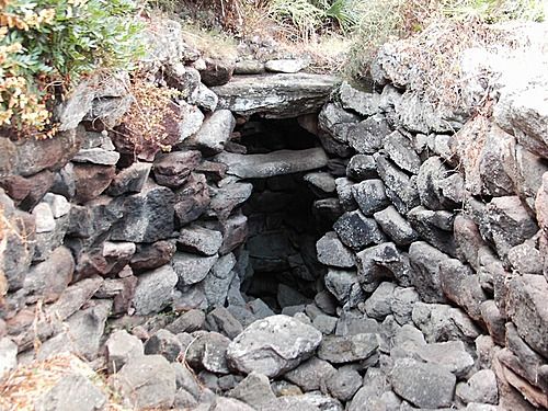
The latter is the most interesting and is characterized by a bethel at the entrance of the village; nuraghe ocupava the central part, while around were arranged the circular stone huts, one of which is still in excellent condition and is equipped with an underground room perhaps for the storage of supplies.
In rock you notice the excavation of a cistern, probably intended to supply water for livestock.
Downstream of the dolmen, instead, is a sacred well designed for worship, which collected and protected the spring waters.
-
località: isola di Sant'Antioco
-
Search
-
Categories
- APP FAITA Sardegna
- HOLIDAY PACKAGES
- CAMPING VILLAGE Sardinia
- Where to eat
- TRANSPORT Sardinia
- BEACHES in Sardinia
- Tours in Sardinia
- KITCHEN traditional Sardinian
- WINES Sardinia
- SPIRITS of Sardinia
- EVENTS in Sardinia
- CORTES Apertas in Sardinia
- SPORT in Sardinia
- MAP Sardinia
- PHOTOS Sardinia
- VIDEO Sardinia
- Useful Numbers Sardinia
- DOGGIE BEACH in Sardinia
- Contact information
- archivio
-
Topics
- Camping e Village Sardinia
- Tourism in Sardinia
- resorts in Sardinia
- Sardinian beaches routes
- Specialties at the table
- South Coast Cagliari
- Costa Rei itinerari
- Ogliastra itinerari
- Nuoro e provincia itinerari
- Gallura itinerari
- Sassari e provincia itinerari
- Oristano e provincia itinerari
- Autunno in Barbagia 2013
- Aerei per la Sardegna
- Traghetti per la Sardegna
- Storia di Sardegna
- Feste e sagre della Sardegna
- Camping Village e Spiagge dog friendly
- Spiagge accessibili con l'amico cane


